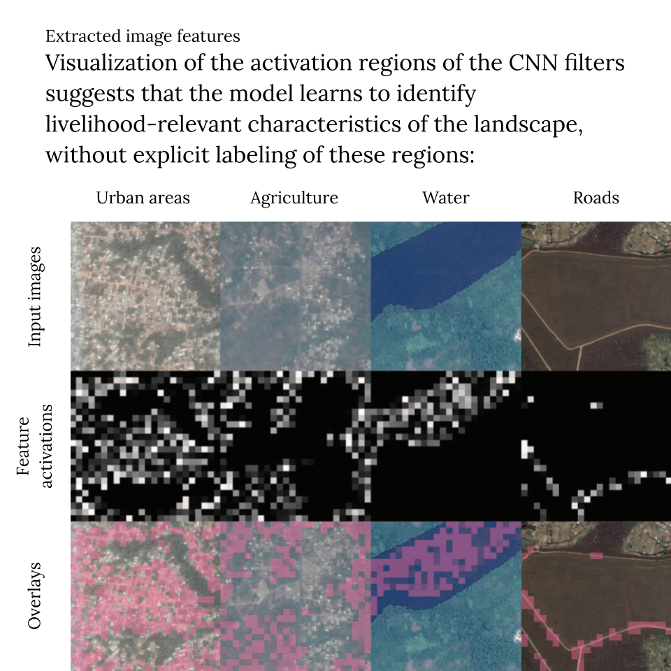
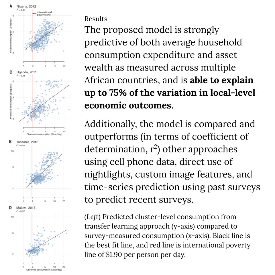
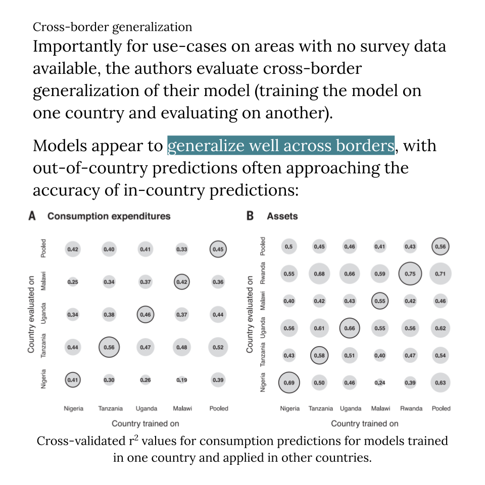
Combining satellite imagery and machine learning to predict poverty.
Jean, Neal, et al. “Combining satellite imagery and machine learning to predict poverty.” Science 353.6301 (2016): 790-794.
For this week’s reading group, I wanted to find examples of AI applied to solving important and immediate real-world problems. In my search, I encountered Stefano Ermon’s group at Stanford - a shining example of a lab dedicated to “innovative computational approaches to help address the societal and environmental challenges of the 21st century”, which I absolutely love.
The problem tackled by this work is a great example of a problem belonging to the category of “low-hanging fruit” that I’ve always believed that machine learning should be perfect for, but in reality it is quite difficult to come up with examples of these problems until you encounter them in the wild. I say “low-hanging fruit” not to belittle the difficulty of this work, but because in terms of research, the technology required is already well-established, so what seems to be the hard part is first hunting out these fruits, then later getting the traction necessary for others to start using your tool.
Anyway, this paper is by now a few years old, and the Ermon Group has done a lot more work along the same vein and others. I found Dr Ermon’s talk “Towards Globally Beneficial AI” to be a very nice overview of their lab’s interests, but their website also lists many more recent publications, including what might be considered a 2021 update to this paper: “Using Satellite Imagery to Understand and Promote Sustainable Development”.
View in Google Slides.
Join the conversation on: